
Cover
Cover illustration: Institute for Civic Service, 2026. Original vector city motif drawn in code (SVG); not a photograph and not AI-generated.
Credits
Every credit line below is copied exactly from The Lost Art of the Plan, Second Edition, 2026 (Image & Figure Credits, printed pages 109 to 111), with source links. Plate 4.3 uses the credits-section version of its line, which carries the fuller disclosure.
Cover illustration: Institute for Civic Service, 2026. Original vector city motif drawn in code (SVG); not a photograph and not AI-generated.
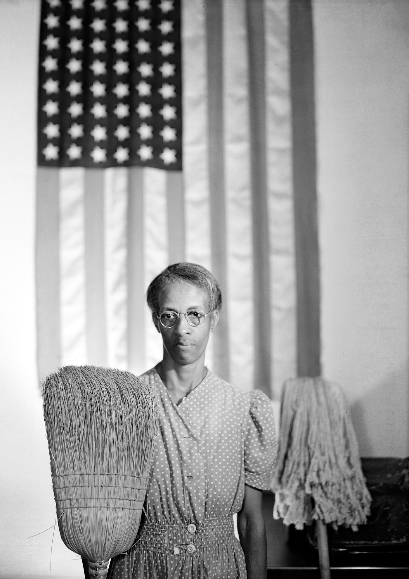
PLATE 0.1 · PHOTOGRAPH, 1942
Before the city wakes. Ella Watson, who cleaned the Washington, D.C., offices of the Farm Security Administration, photographed by Gordon Parks in August 1942. Every city runs on public servants few people see.
Image: Gordon Parks (FSA-OWI), "American Gothic (Ella Watson, Washington, D.C.)," August 1942. Library of Congress, Prints & Photographs Division, FSA-OWI Collection, LC-DIG-fsa-8b14845. Public domain (work of the U.S. federal government). Not altered by ICS; resized for print. Source: https://commons.wikimedia.org/wiki/File:Gordon_Parks_-_American_Gothic.jpg
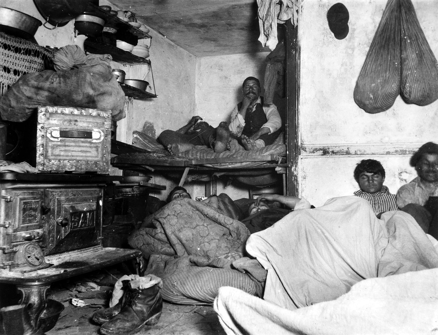
PLATE 1.1 · PHOTOGRAPH, C. 1889
The witness with a camera. Lodgers sleeping in tiers in a single room of a Bayard Street tenement, New York, photographed by Jacob A. Riis (catalogued 1889) and published in How the Other Half Lives (1890).
Image: Jacob A. Riis, "Lodgers in a Crowded Bayard Street Tenement," 1889. Museum of the City of New York, Jacob A. Riis Collection, scan via Wikimedia Commons. Public domain (published 1890). Not altered by ICS; resized for print. Source: https://commons.wikimedia.org/wiki/File:Jacob_Riis,_Lodgers_in_a_Crowded_Bayard_Street_Tenement.jpg
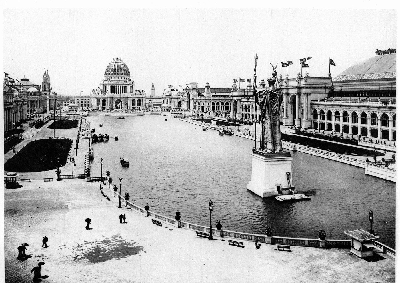
PLATE 1.2 · PHOTOGRAPH, 1893
The White City. The Court of Honor and Grand Basin of the World’s Columbian Exposition, Chicago, 1893, with the Statue of the Republic in the foreground and the Administration Building dome closing the vista.
Image: C. D. Arnold and H. D. Higinbotham, official photographers of the exposition, "The Court of Honor (Plate 15, Official Views of the World’s Columbian Exposition)," 1893. Official Views of the World’s Columbian Exposition (1893), scan via Project Gutenberg, via Wikimedia Commons. Public domain (published 1893). Not altered by ICS; resized for print. Source: https://commons.wikimedia.org/wiki/File:The_Court_Of_Honor_%E2%80%94_Official_Views_Of_The_World%27s_Columbian_Exposition_%E2%80%94_15.jpg
Site note: Cropped and tinted for the web by ICS. On the home page this plate is the hero image, in the ICS blue duotone the Chair directed; the printed plate is unchanged.
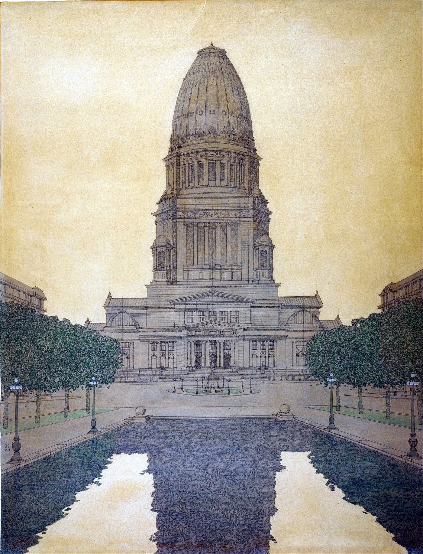
PLATE 1.3 · RENDERING, 1908
The plan as a vision. Jules Guérin’s rendering of the proposed Civic Center for Daniel H. Burnham and Edward H. Bennett’s Plan of Chicago (1909): a domed civic building commanding its plaza.
Image: Jules Guérin (delineator); Daniel H. Burnham and Edward H. Bennett (architects), "Plan of Chicago: Civic Center," 1908; published 1909. Google Art Project, asset bgHo64aXidhmtA, via Wikimedia Commons. Public domain (published 1909). Not altered by ICS; resized for print. Source: https://commons.wikimedia.org/wiki/File:Delineator-_Jules_Guerin;_Architects-_Edward_Herbert_Bennett_and_Daniel_Hudson_Burnham_-_Plan_of_Chicago-_Civic_Center_-_Google_Art_Project.jpg
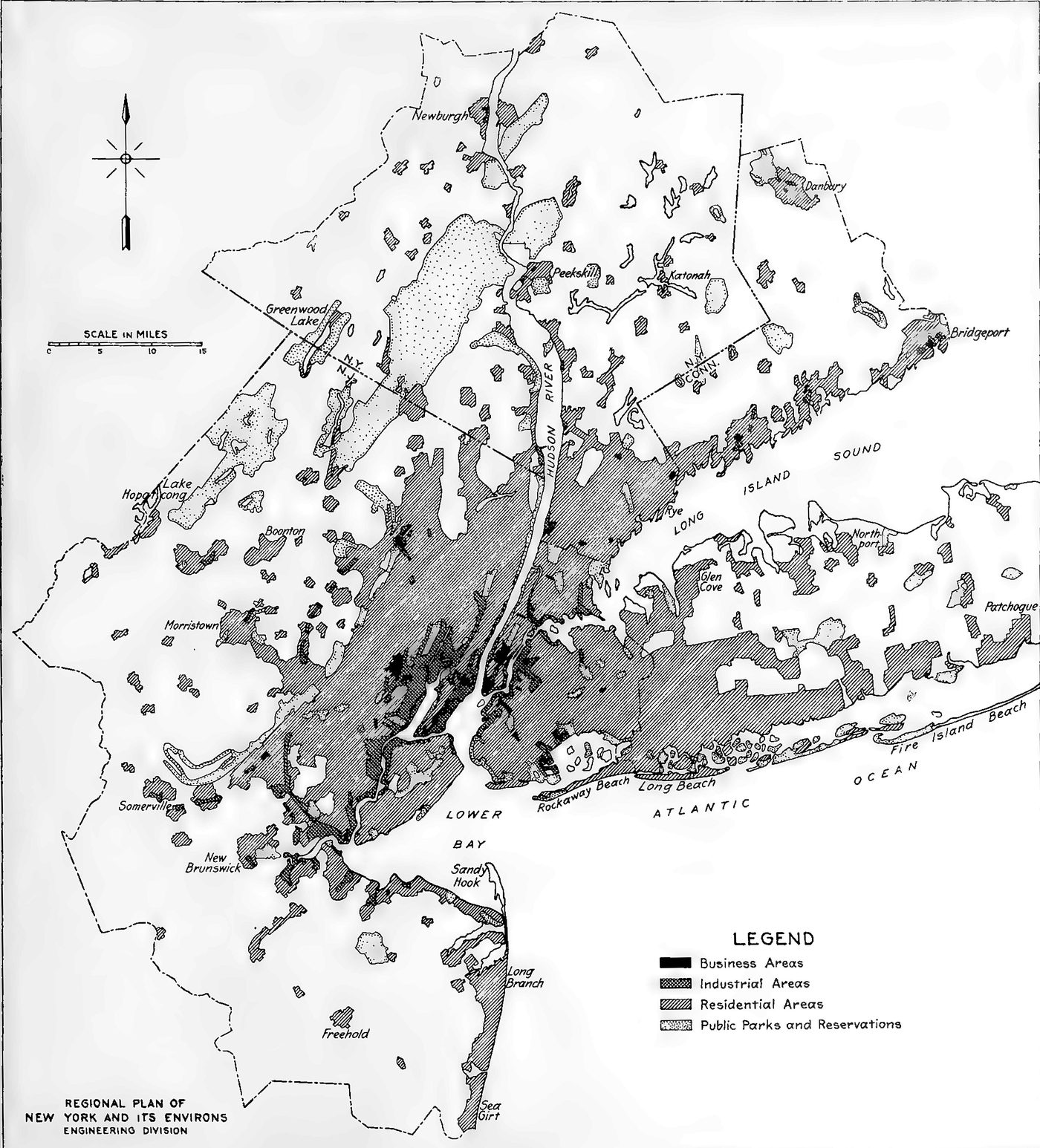
PLATE 2.1 · MAP, 1929
The region, drawn. "General Plan of the Proposed Land Uses for New York and Its Environs," Fig. 34 of The Graphic Regional Plan (1929): the whole metropolitan region on a single sheet.
Image: Engineering Division, Regional Plan of New York and Its Environs (Thomas Adams, Director of Studies), "General Plan of the Proposed Land Uses for New York and Its Environs (Fig. 34, The Graphic Regional Plan, Vol. I, p. 401)," 1929. Internet Archive, scanned library copy, item graphicregionalp0000unse. Public domain (U.S. publication before 1930). Cropped by the image researcher to the figure frame from the page scan. Not altered by ICS; resized for print. Source: https://archive.org/details/graphicregionalp0000unse
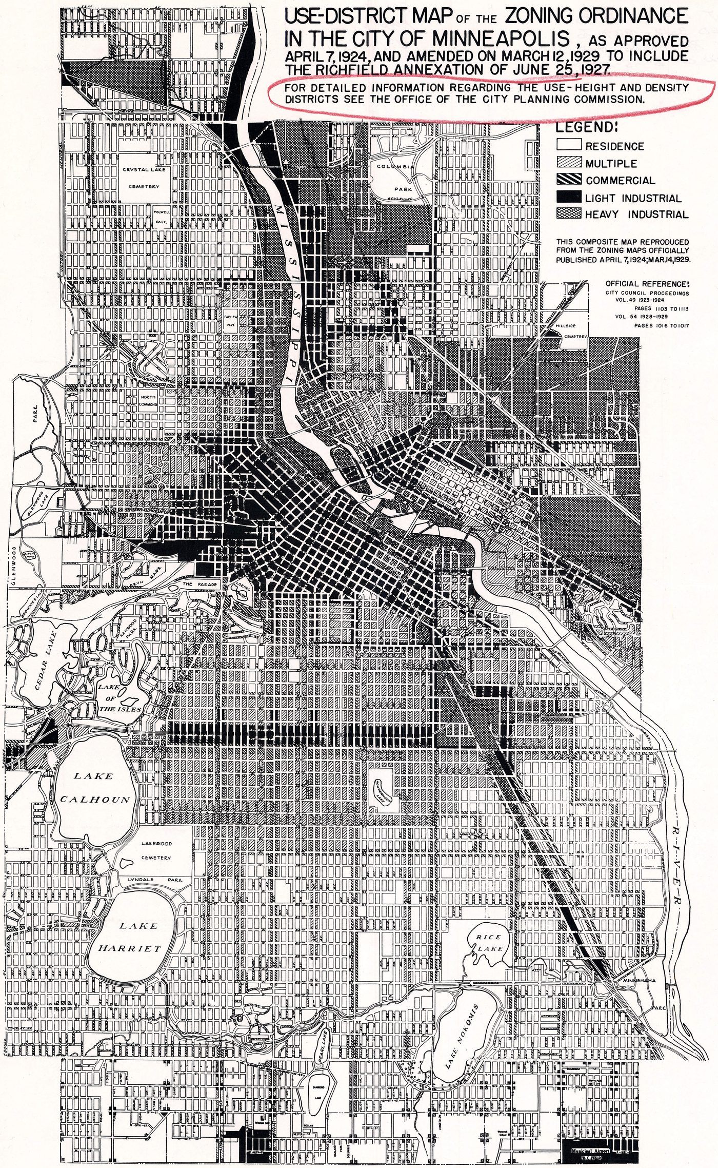
PLATE 2.2 · MAP, 1924, AMENDED 1929
The city in color-coded pieces. The use-district (zoning) map of Minneapolis as approved in 1924 and amended to 1929, dividing the whole city into residence, multiple dwelling, commercial, and industrial districts.
Image: City Planning Commission, City of Minneapolis, "Use District Map of the Zoning Ordinance in the City of Minneapolis, as Approved April 7, 1924 and Amended March 12, 1929," 1924; amended 1929. Hennepin County Library, James K. Hosmer Special Collections, via the Digital Public Library of America, DPLA 6aff617899b819dfcbe71b8443aad848. Public domain (U.S. publication before 1930; no known copyright). Not altered by ICS; resized for print. Source: https://dp.la/item/6aff617899b819dfcbe71b8443aad848
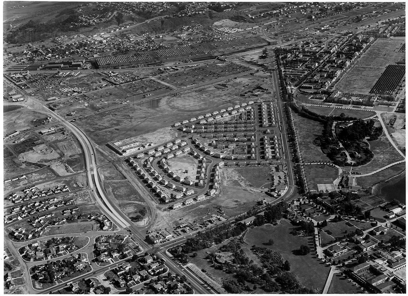
PLATE 2.3 · PHOTOGRAPH, C. 1941–42
Planning goes to war. Newly built defense housing for war workers on open mesa land, San Diego, California, photographed by the U.S. Navy from 2,000 feet, c. 1941–42.
Image: Unknown U.S. Navy photographer, "Aerial view of Defense Housing unit looking north, San Diego, California. Altitude 2000 Feet," c. 1941–42. U.S. National Archives and Records Administration, RG 80-G, NAID 295625. Public domain (work of the U.S. federal government). Not altered by ICS; resized for print. Source: https://commons.wikimedia.org/wiki/File:Aerial_view_of_Defense_Housing_unit_looking_north,_San_Diego,_California._Altitude_2000_Feet._-_NARA_-_295625.jpg
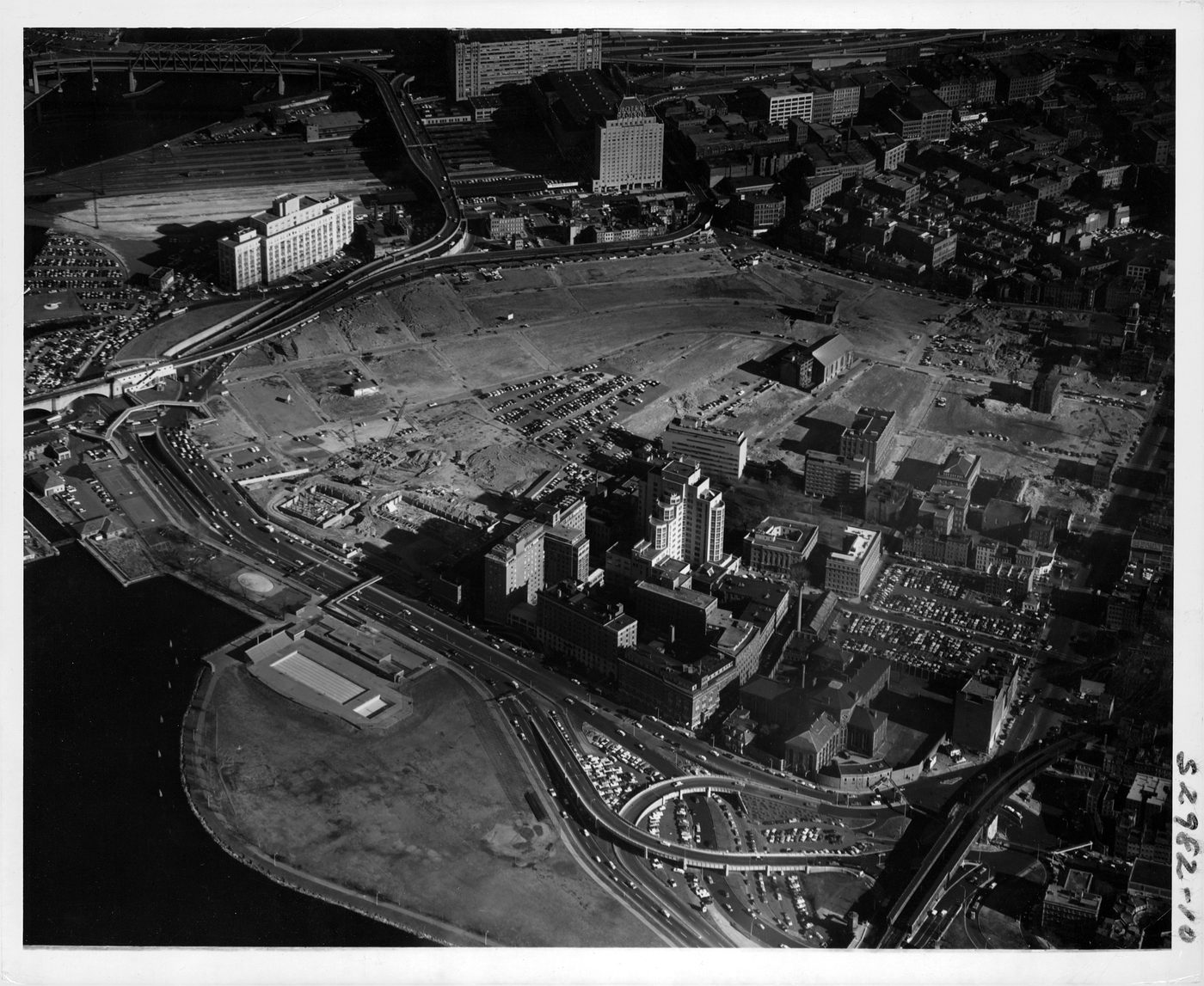
PLATE 3.1 · PHOTOGRAPH, C. 1959–64
The cure. Boston’s West End, a dense working-class neighborhood, after clearance under Title I urban renewal: dozens of city blocks reduced to open ground. Catalogued c. 1959–64.
Image: "West End project area looking northeasterly" by Urban Redevelopment Division, Boston Housing Authority, City of Boston Archives (file no. 01-2962-10), via Wikimedia Commons, c. 1959–64. CC BY 2.0 (https://creativecommons.org/licenses/by/2.0/). Tones adjusted for this edition by ICS; resized for print. Source: https://commons.wikimedia.org/wiki/File:West_End_project_area_looking_northeasterly.jpg
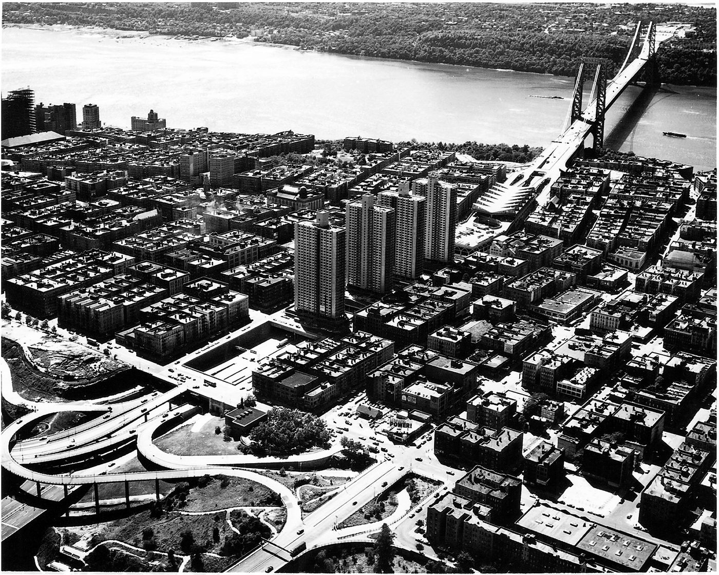
PLATE 3.2 · PHOTOGRAPH, 1965
Concrete knives. Interstate 95’s Trans-Manhattan Expressway cut through the tenement grid of Washington Heights, New York, 1965, with the four Bridge Apartments built directly over the trench.
Image: Federal Highway Administration (Bureau of Public Roads), "NY 8 I95 FHWA 1965 46 (Trans-Manhattan Expressway, Washington Heights)," 1965. Federal Highway Administration, Interstate Photo Gallery, via Wikimedia Commons. Public domain (work of the U.S. federal government). Not altered by ICS; resized for print. Source: https://commons.wikimedia.org/wiki/File:NY_8_I95_FHWA_1965_46.jpg
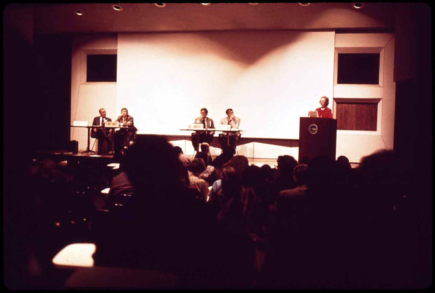
PLATE 4.1 · PHOTOGRAPH, 1973
The advocate in the room. A resident addresses officials at a public forum on transportation and clean air, New York, August 1973.
Image: Dan McCoy (DOCUMERICA), "Citizens Meeting on Transportation, a Forum on "Strategies for Clean Air" Proposed by the New York City EPA," August 1973. U.S. National Archives and Records Administration, DOCUMERICA, RG 412, NAID 554333. Public domain (work of the U.S. federal government). Not altered by ICS; resized for print. Source: https://commons.wikimedia.org/wiki/File:CITIZENS_MEETING_ON_TRANSPORTATION,_A_FORUM_ON_%22STRATEGIES_FOR_CLEAN_AIR%22_PROPOSED_BY_THE_NEW_YORK_CITY_EPA_-_NARA_-_554333.jpg
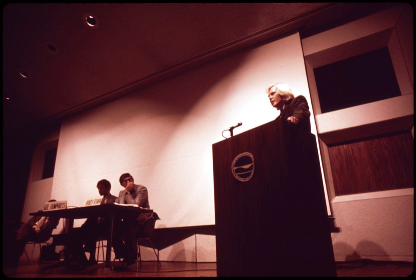
PLATE 4.1A · PHOTOGRAPH, 1973
At the podium. The same New York forum on transportation and clean air, August 1973, seen from closer in: a speaker at the podium, officials at the table beside her.
Image: Dan McCoy (DOCUMERICA), "Citizens Meeting on Transportation, a Forum on "Strategies for Clean Air" Proposed by the New York City EPA," August 1973. U.S. National Archives and Records Administration, DOCUMERICA, RG 412, NAID 554342. Public domain (work of the U.S. federal government). Not altered by ICS; resized for print. Source: https://commons.wikimedia.org/wiki/File:CITIZENS_MEETING_ON_TRANSPORTATION,_A_FORUM_ON_%22STRATEGIES_FOR_CLEAN_AIR%22_PROPOSED_BY_THE_NEW_YORK_CITY_EPA_-_NARA_-_554342.jpg
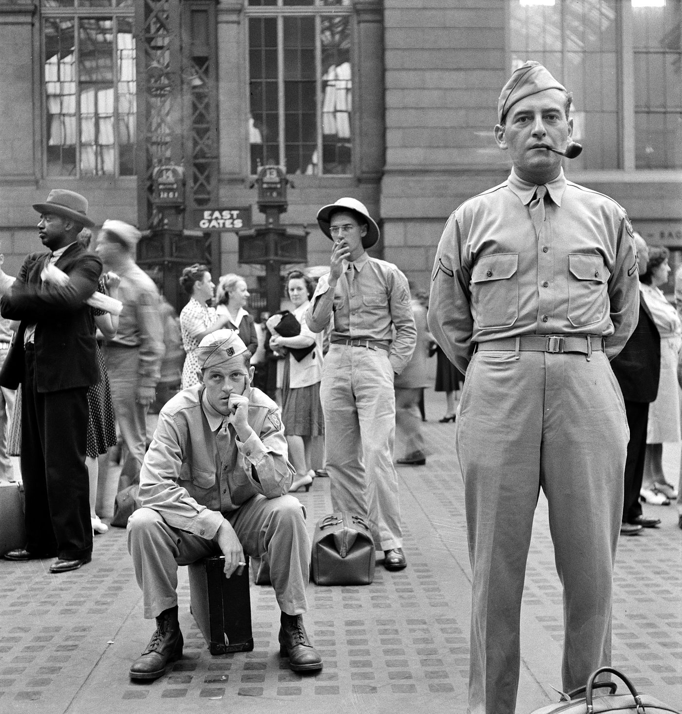
PLATE 4.2 · PHOTOGRAPH, 1942
The loss that taught preservation. Travelers in Pennsylvania Station, New York, August 1942, two decades before the station’s demolition began in 1963.
Image: Marjory Collins (FSA-OWI), "Loners in a crowd. Waiting for trains at the Pennsylvania railroad station, in New York City, New York," August 1942. Library of Congress, Prints & Photographs Division, FSA-OWI Collection, scan via Wikimedia Commons. Public domain (work of the U.S. federal government). Not altered by ICS; resized for print. Source: https://commons.wikimedia.org/wiki/File:Loners_in_a_Crowd-_Waiting_for_trains_at_the_Pennsylvania_railroad_station,_in_New_York_City,_New_York,_August_1942.jpg
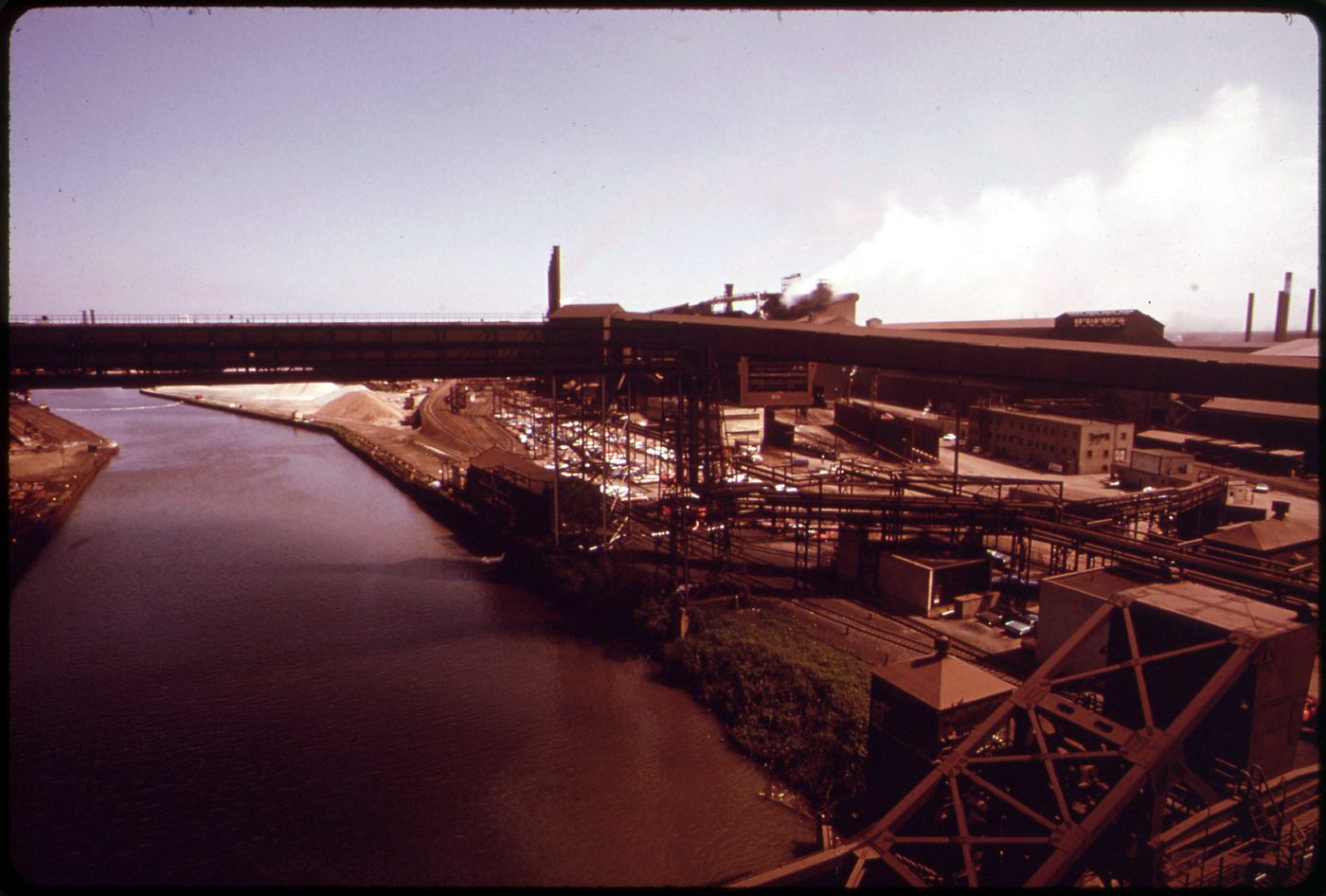
PLATE 4.3 · PHOTOGRAPH, 1973
The river that burned. The Cuyahoga River in Cleveland’s industrial Flats, with steelworks on the far bank, May 1973. This is not a photograph of the 1969 fire.
Image: Frank John Aleksandrowicz (DOCUMERICA), “Cuyahoga River Waterfront,” May 1973. U.S. National Archives and Records Administration, DOCUMERICA, RG 412, NAID 550225. Public domain (work of the U.S. federal government). Restored for this edition with AI assistance (slide-frame edges removed; scene unchanged); resized for print. Source: https://commons.wikimedia.org/wiki/File:CUYAHOGA_RIVER_WATERFRONT_-_NARA_-_550225.jpg
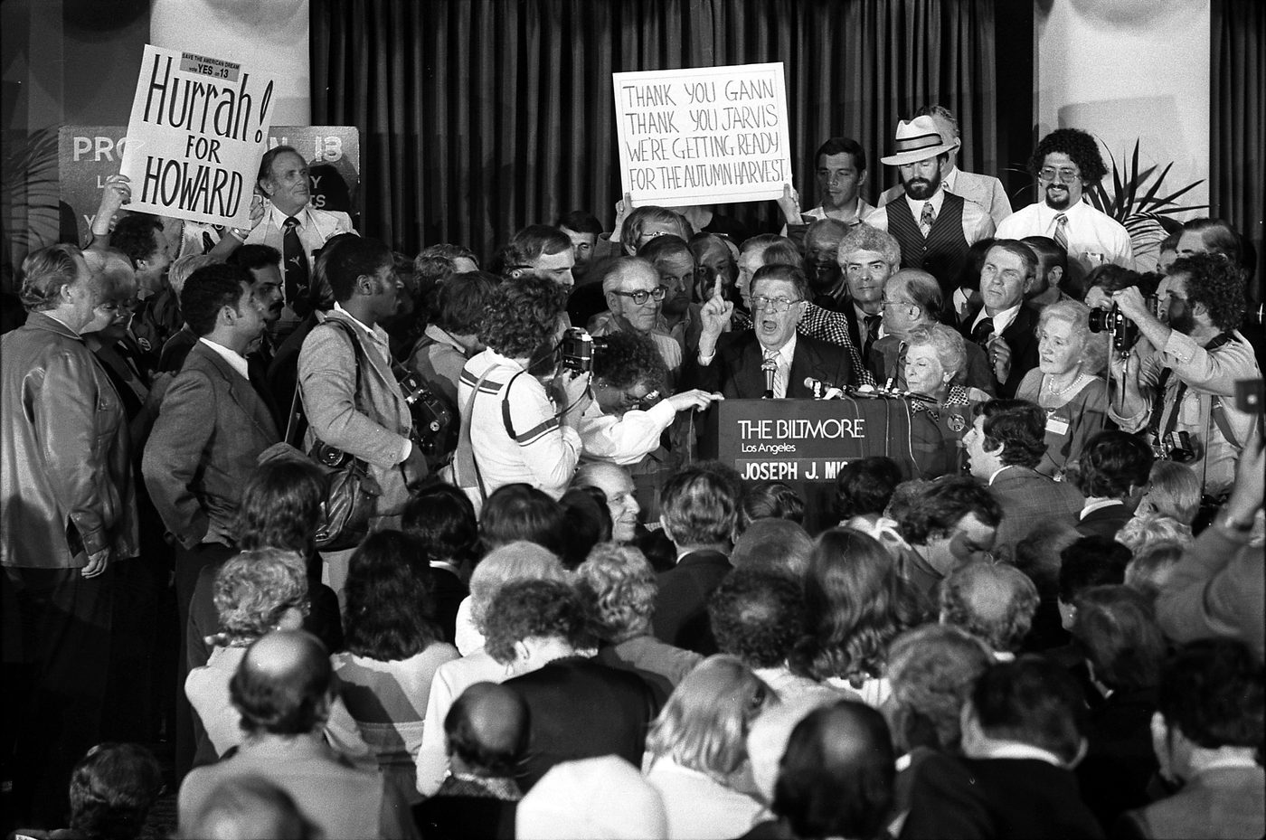
PLATE 4.4 · PHOTOGRAPH, 1978
The tax revolt. Howard Jarvis, the public face of California’s Proposition 13, among supporters and press after the measure passed in June 1978.
Image: "Howard Jarvis after California Proposition 13 victory" by Mike Meadows, Los Angeles Times, Los Angeles Times, via Wikimedia Commons, June 8, 1978 (as catalogued). CC BY 4.0 (https://creativecommons.org/licenses/by/4.0/). Not altered by ICS; resized for print. Source: https://commons.wikimedia.org/wiki/File:Howard_Jarvis_after_California_Proposition_13_victory.jpg
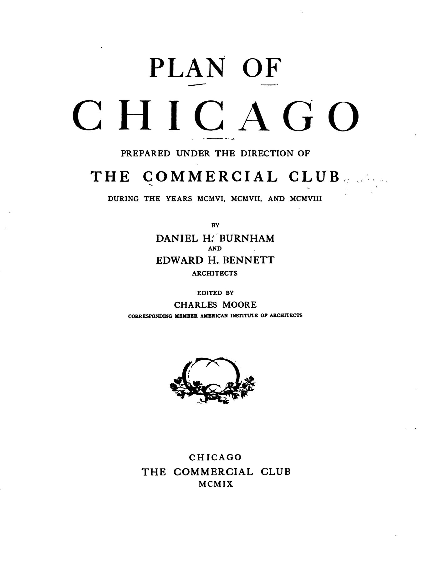
PLATE 5.1 · PRINTED PAGE, 1909
The plan as artifact. The title page of the Plan of Chicago (1909), prepared under the direction of the Commercial Club of Chicago by Daniel H. Burnham and Edward H. Bennett, edited by Charles Moore.
Image: Daniel H. Burnham and Edward H. Bennett (authors); Charles Moore (editor); The Commercial Club of Chicago (publisher), "Plan of Chicago, title page," 1909. Internet Archive, digitized copy (Google Books scan), item planchicagoprep00moorgoog, leaf n15. Public domain (published 1909). Not altered by ICS; resized for print. Source: https://archive.org/details/planchicagoprep00moorgoog
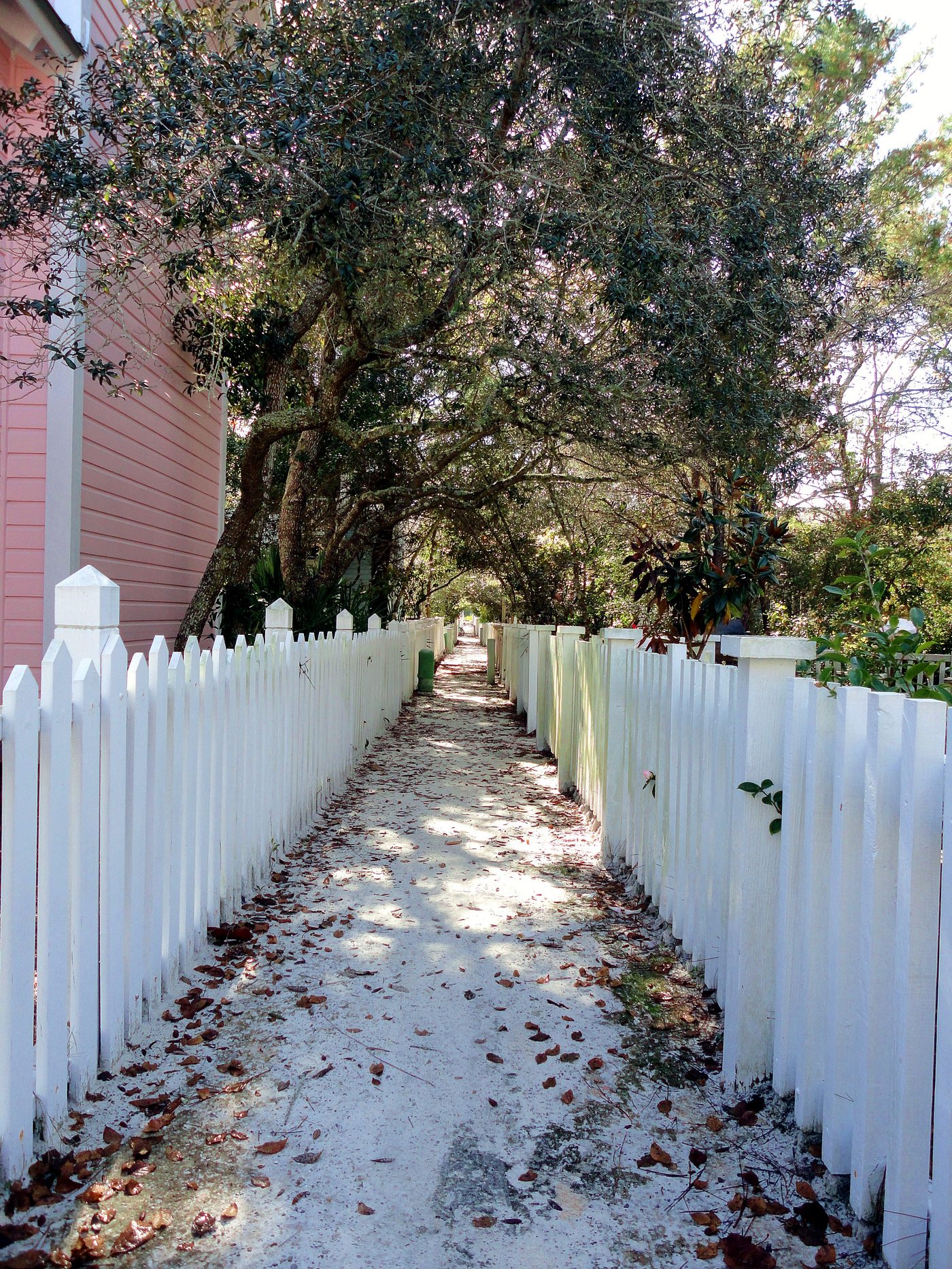
PLATE 5.2 · PHOTOGRAPH, BY 2010
The return of the porch. A picket-fenced footpath in Seaside, Florida (founded 1981), shown as the best-known built example of New Urbanism. The text names the movement, not a town.
Image: "Seaside Alley" by M.Fitzsimmons, Wikimedia Commons, uploaded November 27, 2010; no date recorded. CC BY-SA 3.0 (https://creativecommons.org/licenses/by-sa/3.0/). Share-alike: this reproduction is shared under the same license. Not altered by ICS; resized for print. Source: https://commons.wikimedia.org/wiki/File:Seaside_Alley.JPG
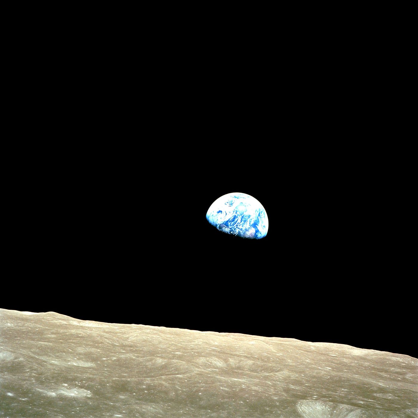
PLATE 5.3 · PHOTOGRAPH, 1968
Seeing the whole. Earth rising above the lunar horizon, photographed by astronaut William Anders from Apollo 8 on December 24, 1968. Sustainability, the subject of this chapter’s later pages, asked planners to see the whole.
Image: William Anders, NASA, "Earthrise," December 24, 1968. NASA, Apollo 8 mission photography, AS08-14-2383. Public domain (NASA imagery; work of the U.S. federal government). Not altered by ICS; resized for print. Source: https://images.nasa.gov/details/as08-14-2383
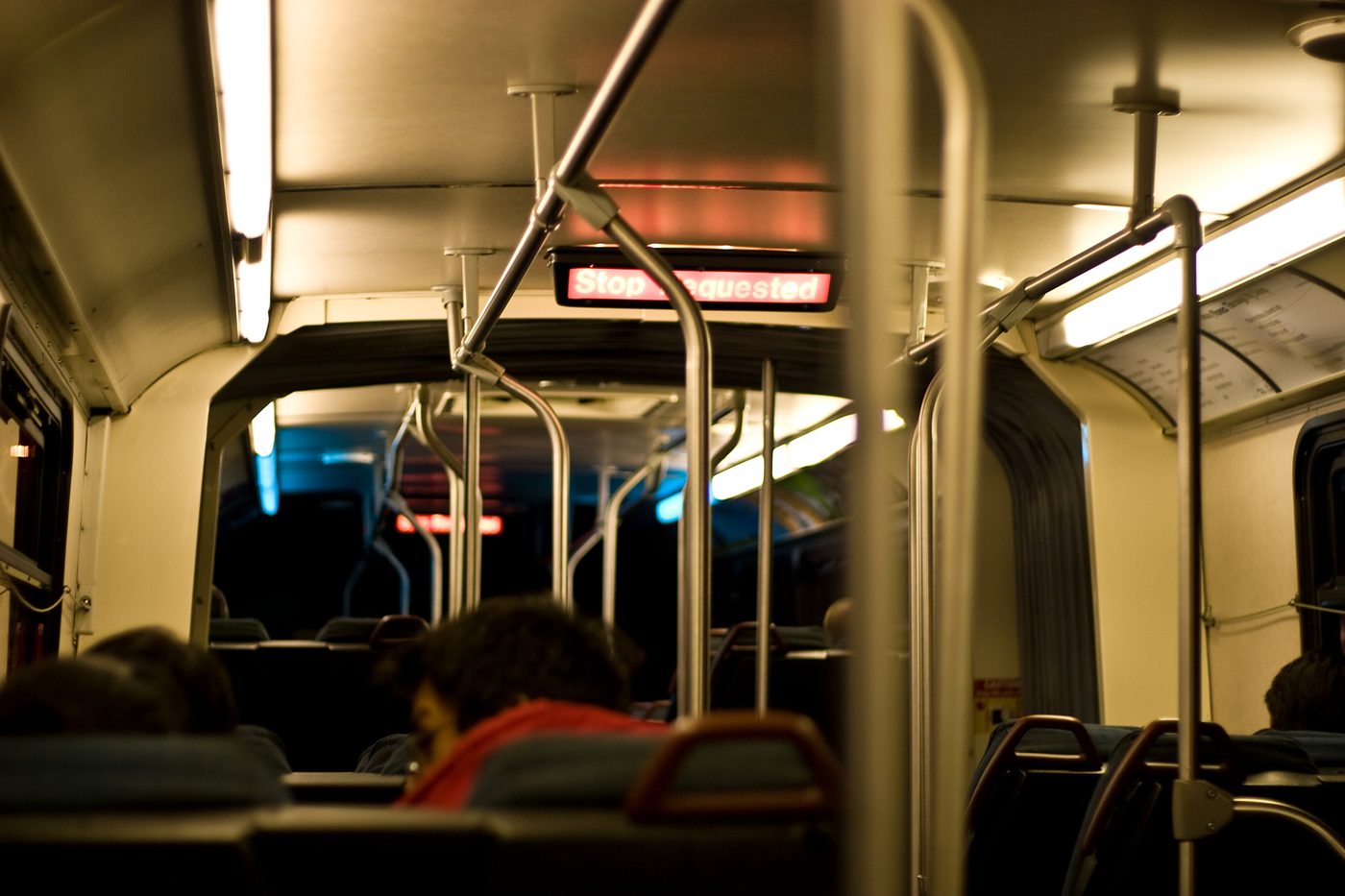
PLATE 6.1 · PHOTOGRAPH, 2007
Boarding in the dark. Riders on a King County Metro bus after nightfall, Seattle, December 2007. A representative image: the riders shown are not people described in the text.
Image: "Seattle Metro 10" by Shawn Henning, Wikimedia Commons (via Flickr), December 8, 2007. CC BY-SA 2.0 (https://creativecommons.org/licenses/by-sa/2.0/). Share-alike: this reproduction is shared under the same license. Not altered by ICS; resized for print. Source: https://commons.wikimedia.org/wiki/File:Seattle_Metro_10.jpg
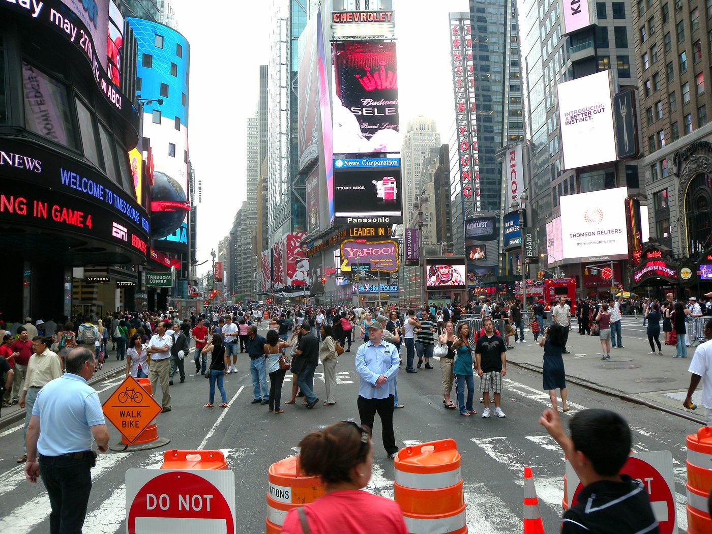
PLATE 6.3 · PHOTOGRAPH, 2009
The courage to test. Broadway at Times Square on May 24, 2009, in the first days of New York’s pedestrian pilot: barrels and signs close the avenue and people stand where traffic ran. The text describes the method, not this city.
Image: Jim Henderson, "TSq Bwy pedestrianized jeh," May 24, 2009. Wikimedia Commons, contributor file. Public domain (released by the photographer). Not altered by ICS; resized for print. Source: https://commons.wikimedia.org/wiki/File:TSq_Bwy_pedestrianized_jeh.jpg
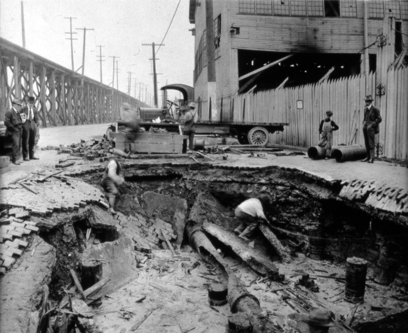
PLATE 7.1 · PHOTOGRAPH, C. 1920S
The tame problem. A municipal crew repairs a water main in an opened street, Seattle, c. 1920s. The problem is visible and the causal chain is direct.
Image: "Seattle - Water main repair, circa 1920s" by Seattle Street & Sewer Department photographer (unknown), Seattle Municipal Archives (Flickr ID 51734361590), via Wikimedia Commons, c. 1920s. CC BY 2.0 (https://creativecommons.org/licenses/by/2.0/). Not altered by ICS; resized for print. Source: https://commons.wikimedia.org/wiki/File:Seattle_-_Water_main_repair,_circa_1920s_(51734361590).jpg
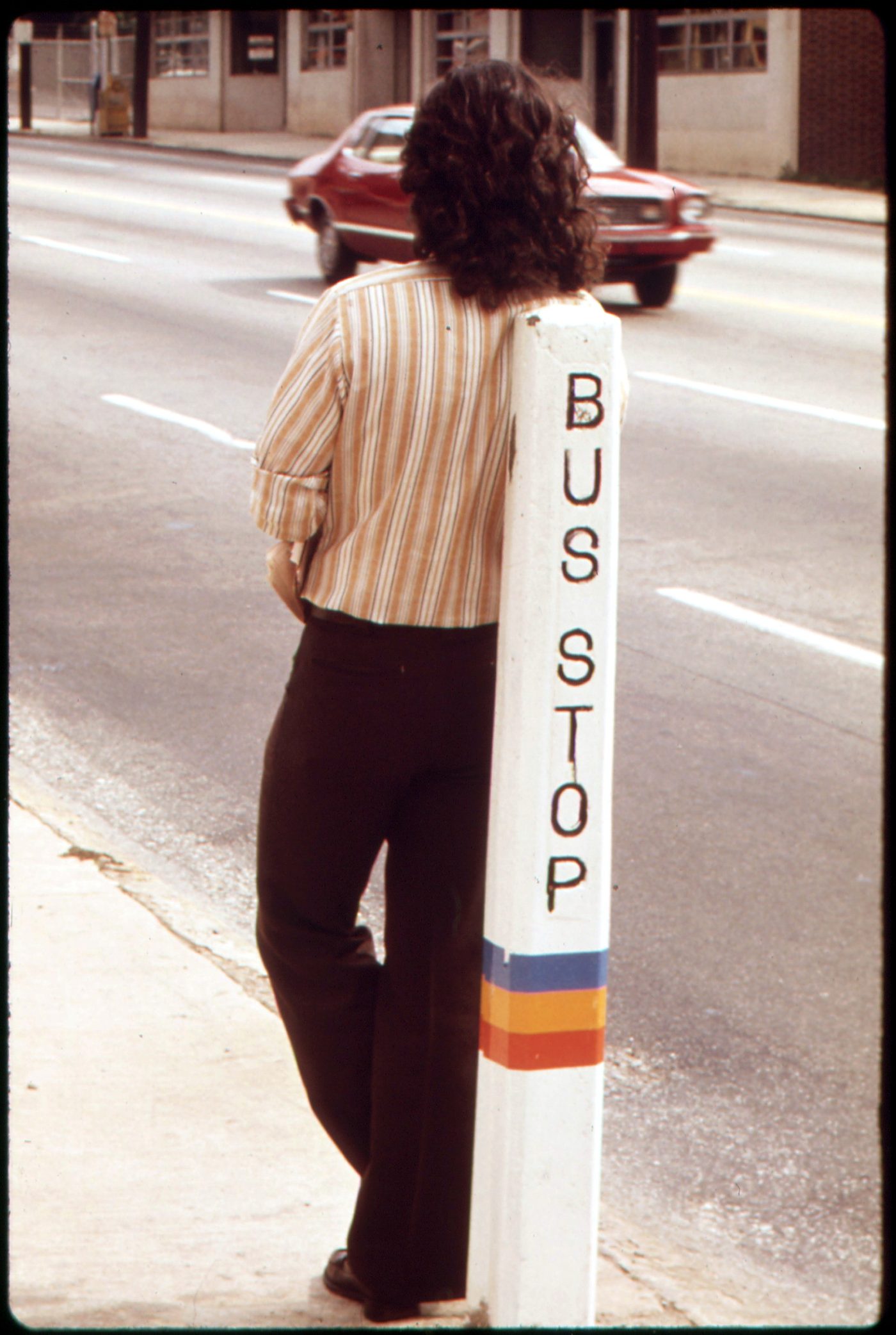
PLATE 7.2 · PHOTOGRAPH, 1974
The pilgrimage. A passenger leans on a bare bus stop post on a wide arterial in Atlanta, June 1974. The teacher in this chapter is a representative narrative; this is not her.
Image: Jim Pickerell (DOCUMERICA), "Bus Stop Is a Leaning Post for a Passenger Waiting for a Metropolitan Atlanta Rapid Transit Authority (MARTA) Bus," June 1974. U.S. National Archives and Records Administration, DOCUMERICA, RG 412, NAID 556799. Public domain (work of the U.S. federal government). Not altered by ICS; resized for print. Source: https://commons.wikimedia.org/wiki/File:BUS_STOP_IS_A_LEANING_POST_FOR_A_PASSENGER_WAITING_FOR_A_METROPOLITAN_ATLANTA_RAPID_TRANSIT_AUTHORITY_(MARTA)_BUS_IN.._-_NARA_-_556799.jpg
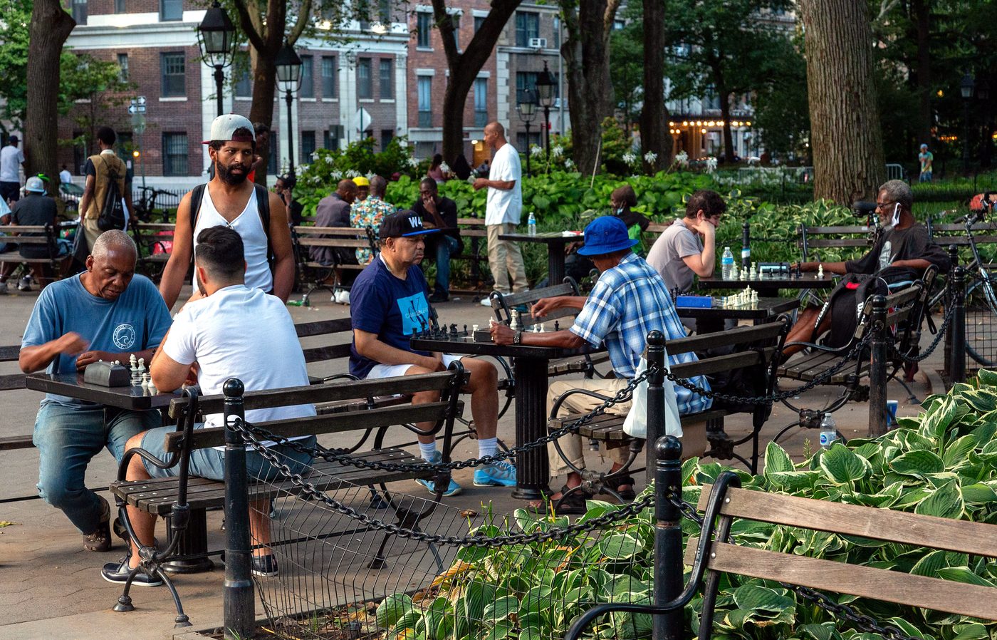
PLATE 7.3 · PHOTOGRAPH, 2021
Arthur’s park. Players at the fixed chess tables of Washington Square Park, New York, August 2021. Arthur Chen is a representative narrative; the people shown are not him.
Image: "Chess players in Washington Square Park" by David Brossard, Wikimedia Commons (via Flickr), August 15, 2021. CC BY-SA 2.0 (https://creativecommons.org/licenses/by-sa/2.0/). Share-alike: this reproduction is shared under the same license. Not altered by ICS; resized for print. Source: https://commons.wikimedia.org/wiki/File:Chess_players_in_Washington_Square_Park.jpg
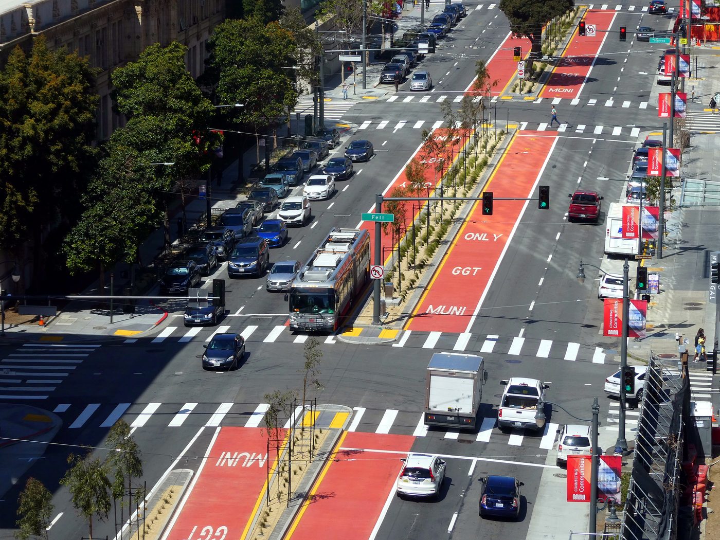
PLATE 8.1 · PHOTOGRAPH, 2022
Chalk, tested. A Muni route 49 bus on the red transit-only lanes of Van Ness Avenue at Fell Street, San Francisco, April 2022. The case study in this chapter is an illustrative composite and names no city.
Image: "Southbound Muni route 49 bus at Fell Street, April 2022" by Pi.1415926535, Wikimedia Commons, April 1, 2022. CC BY-SA 4.0 (https://creativecommons.org/licenses/by-sa/4.0/). Share-alike: this reproduction is shared under the same license. Not altered by ICS; resized for print. Source: https://commons.wikimedia.org/wiki/File:Southbound_Muni_route_49_bus_at_Fell_Street,_April_2022.JPG
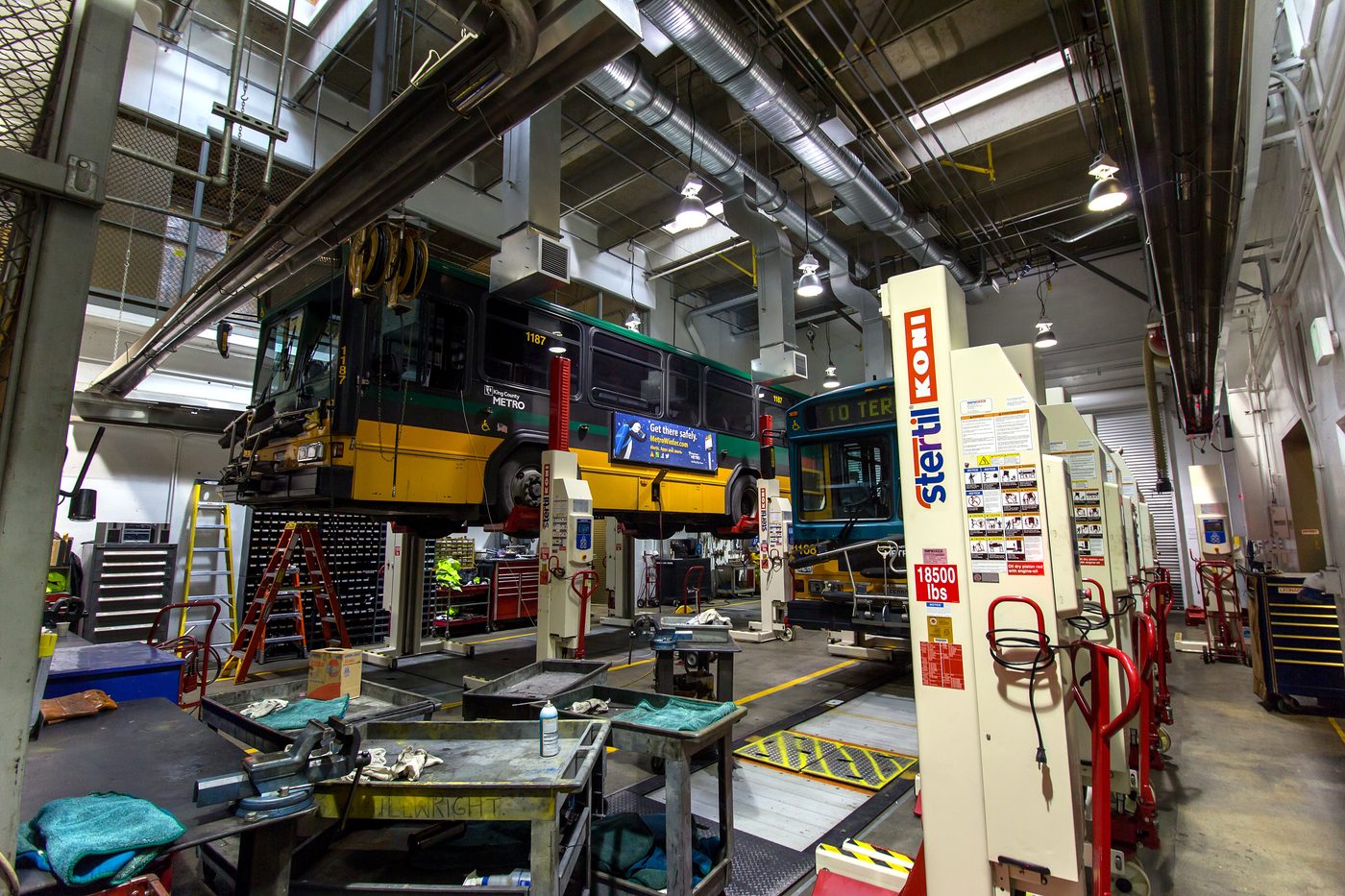
PLATE 8.2 · PHOTOGRAPH, 2017
The hidden balance sheet. Buses raised on lifts in the maintenance bays of King County Metro’s Bellevue Base, Washington, January 2017.
Image: "King County Metro Bellevue Base bus lifts" by Atomic Taco, Wikimedia Commons (via Flickr) (Flickr ID 32227239963), January 10, 2017. CC BY-SA 2.0 (https://creativecommons.org/licenses/by-sa/2.0/). Share-alike: this reproduction is shared under the same license. Not altered by ICS; resized for print. Source: https://commons.wikimedia.org/wiki/File:King_County_Metro_Bellevue_Base_bus_lifts_(32227239963).jpg
Figure 1: A century of the American plan. Institute for Civic Service, 2026. Based on Peterson (2009); Village of Euclid, Ohio v. Ambler Realty Co. (1926); Davidoff (1965); Demonstration Cities and Metropolitan Development Act (1966); National Historic Preservation Act (1966); National Environmental Policy Act (1969); Housing and Community Development Act (1974).
Figure 2: The ideal of the rational plan. Institute for Civic Service, 2026.
Figure 3: The human cost of the cure. Institute for Civic Service, 2026. Based on Biles (2000).
Figure 4: A tower of Babel. Institute for Civic Service, 2026. Based on Village of Euclid, Ohio v. Ambler Realty Co. (1926); Public Works and Economic Development Act (1965); Land and Water Conservation Fund Act (1965); National Historic Preservation Act (1966); Kaiser et al. (1968); National Environmental Policy Act (1969); Housing and Community Development Act (1974).
Figure 5: Five ways of planning the city. Institute for Civic Service, 2026. Based on Davidoff (1965); Berke (2002).
Figure 6: From chalk to capital. Institute for Civic Service, 2026.
Every infographic uses only facts, dates and figures stated in the text of this book or in its Works Cited. Figure 6 charts an illustrative scenario from Chapter 8, not data from a named city.
Photographs and documents are reproduced true to their sources: color where the original is color, black and white where it is black and white. No plate is tinted or retouched, except as noted in the credits. No photograph in this book is AI-generated; the presentation sketches are AI-generated drawings, credited in the Image & Figure Credits.
The nine presentation sketches in this book are AI-generated drawings created for it in 2026. No photograph in this book is AI-generated.
Typefaces: DM Sans (headings and labels). Colophon Foundry for Google Fonts; SIL Open Font License 1.1. TeX Gyre Heros (body text; a Helvetica-class face). GUST e-foundry; GUST Font License.
The seven sketches on the story page are new line illustrations drawn in code for this website, in the site’s block and street motif. They are not the book’s sketches, not photographs, and not historical images.


.jpg)
_BUS_IN.._-_NARA_-_556799.jpg)


.jpg)